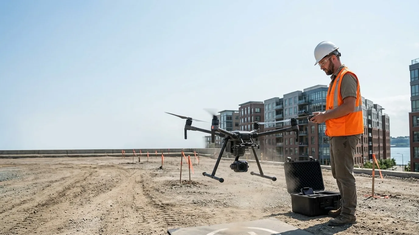
Development and commercial real estate
Show the building, the views and the context before any of it exists.
Aerial stills, video and 360 panoramas for pre-sales, leasing, investor decks and view studies. For developers, brokers and marketing teams working on commercial and multi-family projects.
Canada-wide · Transport Canada Advanced RPAS · Commercially insured
In plain terms
- What you get
- Photos, video and 360 views captured at the exact height of each floor, plus context shots of the neighbourhood, all licensed to you outright.
- What it saves you
- One capture reused across the brochure, the listing and the investor deck, and the view question answered before it costs you a sale.
- Use it when
- Pre-sales, leasing, investor decks, view studies, or marketing a site that is still a parking lot.
The view from the twelfth floor, captured before the second floor is poured.
This is for developers, brokers and marketing teams who have to sell or lease something that is not built yet, or explain a property that only makes sense from above.
Renderings show the building. They do not show the real view from the ninth floor on a Tuesday, or how close the site actually is to the transit station.
Aerial capture does. Stills and 360 panoramas at the exact elevation of each floor, context obliques that put the parcel in its neighbourhood, and video for the launch. All of it captured once, licensed to you outright, and reusable across the brochure, the listing and the investor deck.
View studies
Exact floor, exact view
Stills and 360s captured at the elevation of each floor, so a buyer or a design team sees precisely what a unit will look out on.
Context
Site, transit, amenities
Oblique aerials that put the parcel in its neighbourhood, with the things that sell it visible: water, transit, parks, the highway.
Marketing
Clean, current, yours
Video and stills captured for your brochure, website and investor deck, licensed to you outright, with a rendered massing overlay where you want it.
Deliverables
What you get
Aerial stills
High resolution obliques and top-downs of the site and its context, colour graded, ready for print and web.
Floor-by-floor 360 view captures
Interactive 360 panoramas at the elevation of each floor or a chosen set, hosted and embeddable, with a compass overlay.
Aerial video
Stabilised 4K clips: reveal, orbit, push-in, flyover. Delivered as raw clips and, if you want, a short edit.
Massing overlay (optional)
Your architect’s massing model placed in the aerial stills and 360s at the correct position and scale.
Site orthomosaic
A measurable base map for site plans, marketing plans and pre-construction records.
Hosting and embeds
360 tours hosted on our end with an embed code for your site or listing, for as long as the project needs it.
- Turnaround
- Agreed at scoping, matched to your launch or listing date
- Delivery
- Shared folder for stills and video; hosted link and embed code for 360s
- Licensing
- Full commercial licence, unrestricted use, no expiry. We never publish your project without written permission.
What it looks like
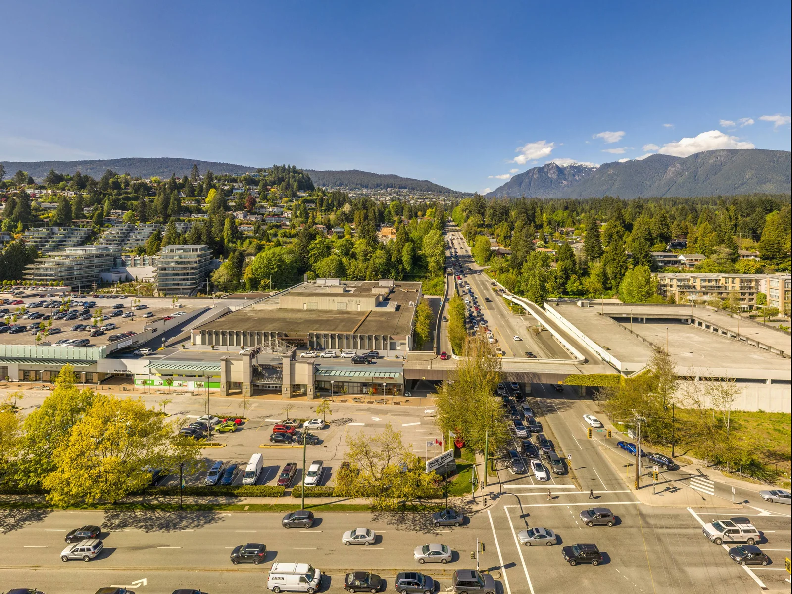
360 elevation view, Gateway Residences
Tower 1, floor 14, looking north. One of ten captures across two towers for Larco Properties.
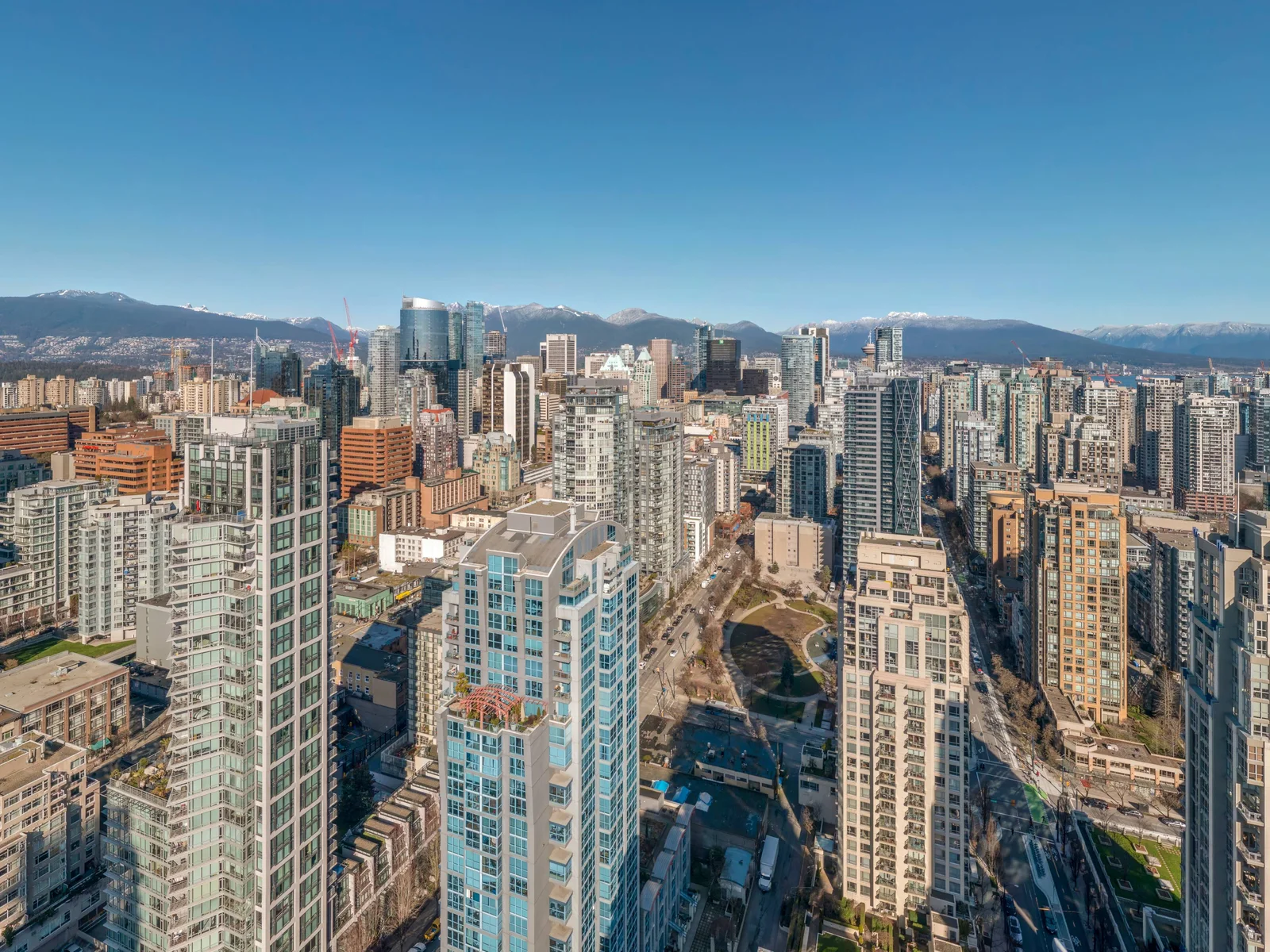
360 elevation view, Drake and Richards
Level 40 of a downtown Vancouver tower, captured before the tower existed, for Larco Properties.
How it works
Brief, capture, deliver.
Brief
What the project is, who the audience is, which floors and views matter, what the brochure needs. We check airspace and light.
Capture
Usually one visit, timed for light. Stills, video and 360s at every requested elevation in a single session.
Deliver
Graded stills and clips, hosted 360s with embed codes, and the massing overlay where scoped.
01
Brief
What the project is, who the audience is, which floors and views matter, what the brochure needs. We check airspace and light.
02
Capture
Usually one visit, timed for light. Stills, video and 360s at every requested elevation in a single session.
03
Deliver
Graded stills and clips, hosted 360s with embed codes, and the massing overlay where scoped.
Compliance
Compliance, in plain terms
Nothing here is a selling point. It is the minimum you should demand from anyone who flies on your site.
Transport Canada Advanced RPAS certificate
The advanced certificate is the one that permits flight in controlled airspace and near people. Every operator Lensdrone dispatches holds it.
Commercial liability insurance
Insured for commercial RPAS operations. Certificate of insurance available on request, naming your company where required.
NAV CANADA airspace authorisation
Controlled airspace near airports needs authorisation before each flight. We handle the request and build the lead time into scheduling.
SFOC where needed
Some operations, such as flights over 122 m or beyond visual line of sight, need a Special Flight Operations Certificate. We tell you up front if your job needs one and manage the application.
Site safety briefing
We attend your site orientation, follow your PPE and access rules, and brief your team on where and when we are flying.
Pricing
Quoted per project. Tell us about the site and you get a scope and a number.
What moves it
- Stills, video, 360 or all three
- Editing and view-line overlays
- Number of visits
In practice
What it looks like on a real job
- The problem
- Two towers at Park Royal, not yet built. Larco needed to show what each floor of each tower would look out on before a single one existed.
- What we captured
- Ten 360 elevation views in one afternoon: Tower 1 at floors 4 to 14, Tower 2 at floors 4 to 10, each positioned over its footprint at that floor’s height, published as one viewer with a floor switcher, a tower switcher and a compass.
- What changed
- The real view from every second floor of both towers, in a link, years before anyone could stand there.
Responsiveness, quality, professionalism, value
“Ben took photos and 360s of our new real estate project. The effort, care and time he put into creating every aspect of a superior product is much appreciated. We highly recommend Benjamin Taft.”
FAQ
Questions people ask before booking
Can you capture the view from a specific floor and unit?
Yes. We fly to the elevation of each floor you specify and capture a 360 panorama at that height, positioned over the unit’s location. A compass overlay shows the orientation.
Can you place our rendering into the aerial?
If your architect can provide a massing or rendered model, yes. We match camera position and lens so the building sits correctly in the photo. It is clearly a rendering, not a fake photo.
Is this only for large projects?
No. A single commercial building for lease, a small infill, a land listing. If the aerial view explains the property better than a ground photo, it is worth doing.
What about residential listings?
Lensdrone works with developers, brokers and marketing teams on commercial and multi-family projects. Individual home listings are not something we take on.
Downtown sites are in controlled airspace. Can you fly there?
Yes. That is what the Advanced RPAS certificate is for. We request NAV CANADA authorisation in advance; it adds a few days of lead time to the first visit.
Next step
Tell us about the site.
Anywhere in Canada. Send the basics and Ben will come back as soon as he can with a scope and a price. If you would rather talk, call.
- Call Ben
- +1 778 889 9306
- [email protected]
- Ballpark in 60 seconds
- Instant estimate